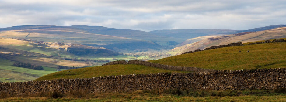
Winterburn Reservoir 12th January 2014
Leader: Sue Williams
Walkers: Angela Phipps, Ian Pickering, Glynis Holmes, John Hamlin, Carol Summers, Peter Howard and Carol Humphries
We set off on a beautiful cold and frosty morning with blue sky and sunshine from the village of Hetton heading towards Winterburn. The scenery looked even better with a coating of frost everywhere (would have made a lovely Christmas card scene).
At first, I was having trouble with some of my party talking about intimate things and I did hear £32 being mentioned for about 15 minutes but very quickly realised that it was the cost of seeing a chiropractor! After that, things settled down and we got on with the business in hand of walking. Before reaching Winterburn, as we were walking through a field, a herd of sheep decided to join the walk so I then had to control 8 walkers and about 50 sheep.
Glynis did ask them if they would like to join the club, but all we got was “baa thank you” and then they left! We stopped for coffee just before the reservoir and found that we had yet more little visitors wanting to join us in the shape of field mice but they were too quick to ask about membership, From there, we walked onwards and upwards towards Weets Top for fine views and lunch which was a little on the chilly side.
Peter’s Carol decided to do a Frosbie Flop over one stile after lunch. Fortunately, she did not hurt herself, but her artistic impressions were very good. I then decided to do a bit of ice skating myself on a farm track near Bordley, but being out of practice I landed on my backside in a heap. Must try harder next time! After that, we had an uneventful walk back to Hetton.
Sutton Bank (Long Walk) 09/03/2014
Leader: Ian Pickering
Walkers: Sue Williams, Michelle Bray, Angela Phipps, Carol Summers, Andrew Sanderson, David Shaw and John Hamlin.
We arrived at Sutton Bank Visitor Centre in lovely sunshine & some walkers in shorts for the first time in a while, although Carol bottled it within minutes of leaving the car. For the first few miles we followed the Cleveland way above Whitestone Cliff and on above Boltby Scar, enjoying wonderful views over Goremire Lake.
At High Barn we descended quickly passed Hesketh Grange to our coffee break in the valley. Onwards to Boltby, we encountered our 1st slight incline of the day. Going up Little Moor, our 2nd slight incline of the day, we walked through a stampede of horses towards our 3rd slight incline. A nice flat section led us to South Woods, where we startled a herd of deer. At this point, wildlife photographer of the year Angela got some great shots of…er…GRASS.
Our route now took us to Goremire Lake, where we took lunch besides the lake in a Wordsworth setting, no Daffodils, but plenty of spring Snowdrops on the ground. After crossing the A170 it was up through Hood Hill plantation for slight inclines 4 and 5. I went easy on the troops and hit the major incline up to the White Horse half way, instead of full hill. Yep, I do have a heart! One last climb up the steps by the horse took us up to Sutton Bank Gliding Club.
We watched the small aeroplanes launching the gliders, where Angela took to aviation photography and got some wonderful shots of …er…SKY. Back at the finish my guess of 12 miles was corrected as 12.1 miles, not bad, but my suggestion that it was a flat walk was answered with 1740 feet of accent. A good walk in good winter weather.
Ingleborough 13.4.14
Leader: Sue Williams
Walkers: Elise, Michelle, John Hamlin, Pat Appleyard, Roger, Josh, Carol Summers.
We set off from Morley with the hope that the weather would be kind to us for a change, but as usual, on the way we could see the cloud getting thicker and more threatening. On arriving at Ribblehead viaduct, the cloud was down and it felt really cold so on went the winter woollies yet again! We headed back along the road towards Selside and turned off over a railway bridge towards Park Fell.
Elise, by this time could see the ascent and how steep it was, so with some trepidation started the long pull up to the summit. In no time at all we were tucked behind a wall having coffee and admiring what views we could see through the clouds at the summit of Park Fell. It was Roger and his son, Josh’s first time up here and they were off like mountain goats and really enjoying the climbs.
From there, we headed on to the summit of Simon Fell and finally Ingle borough which was shrouded in thick cloud. It was disappointing not to see the Lakeland Fells and Morecambe Bay, but that is the luck of the draw. We then descended down the very steep path towards Chapel le Dale, but turned off underneath Ingleborough towards Great Douk Caves.
On the way, Pat was fascinated with a cave entrance which joins Great Douk cave. I did say that we would meet her at the exit of the cave system, but she reluctantly declined the offer!! We finally got back to Ribblehead Viaduct having met loads of people during the day doing the Three Peaks Challenge Walk. Rather them than us. Anyway, everyone enjoyed the walk and I am sure that Elise slept well that night after all the ascents that day.
Digley (medium walk) 06/04/14
Leader: Dave Bennett
Walkers: Jonathon Myers, John and Sonia Hamlin, Elise Horn, Mick Mulhearn, Ian Hewitt, Pat and Graham Smith, Jill and Andy McFarlane, Pam Alderson, Laurie Hutchison, Andrew Sanderson, Peter Howard and Carol Humphries, Robert Thompson, Mary Kennedy, Bev Gaunt, Lauren Garside, Paul Garside, Pat and I.
Twenty two people turned out for a walk from Digley Reservoir, Holmebridge on a day when the weather forecasts suggested we could get very wet.
We parked the cars in the Water Company car park adjacent to the reservoir and proceeded to don our walking gear. True to form just as we seemed ready to walk the heavens opened and waterproofs were quickly donned. We started with a steep little rise up the road to reach the first of what turned out to be a lot of awkward stiles. There followed a lengthy field walking section which took us, via lots of awkward stiles and a steep downhill section, to Liphill Bank an old mill settlement where the industrial buildings have seen better days.
Having lost considerable height dropping down to Liphill Bank, my sense of fun led us to climb out of the valley on the other side to reach the main road. Here the 1:50K map shows a footpath leading directly to Dean Road whilst the 1:25K map does not! I chose to walk on the 1:50K version but unfortunately on the ground the 1:25K wins out! A shortish diversion became necessary, again via fields and awkward stiles.
A section of road walking followed before we again left the road to cross fields to gain Harden Hill Road.
I had originally sorted out the route as the short walk for January last year but it had been cancelled due to snow. To lengthen the walk to medium I now intended to walk almost down to Meltham before climbing back up Magdalen Road. On the day the difficult stiles had resulted in the party making very slow progress so I took the decision to revert to my original short route via Harden Clough. This is an interesting little wooded valley but it has quite an awkward exit via narrow ledgy paths.
Having regained the main road I now reverted to my planned medium walk route by walking up the road to the top of Magdalen Road. From here our route took us via Springs Road and Nether Lane on a wide stoney track all the way back to the waiting cars. Our recorded mileage came out at 8.15 so perhaps it was as well that I diverted via Harden Clough!
As is customary all the party expressed satisfaction and thanked me for a ‘nice’ walk.
Marsden Walk (Medium walk) 04/05/2014
Leader: Ian Pickering
Walkers: Pat Appleyard, Angela Phipps, Val Chadwick, myself and three new walkers Helen, Ian & Shari
As I arrived at Morrisons, I wasn’t expecting many walkers, with the club holiday been held & the weather forecast was not brilliant, but there was 7 of us ready and willing. We parked at Marsden railway station & new walker Shari found her flask had leaked in the car on the way, not a good start. We set off along the Huddersfield narrow canal & within minutes we had our second leak of the day, as Val’s water leaked through her pack.
We continued on to Standedge Tunnel, where the canal goes underground to Diggle about 4 miles away. After a pleasant stroll through a nature trail we arrived at a classic packhorse bridge at Eastergate. The next few miles was spent climbing the moors over March Haigh to join the Pennine Way heading south towards Standedge, a rugged rocky outcrop overlooking Castleshaw Reservoir. As we left the Pennine way & descended from the ridge, new member Shari thought she had spotted a snake, but it was actually a small Common Lizard, Pat tried to hold the creature but it was quickly into the undergrowth.
After lunch at an old building we crossed the Manchester Road and passed a pub, much to Pat’s disappointment. We now had a choice of a tough climb up Pule Hill or along the lower path, new walker Helen insisted it should be the lower route. However, a few hundred yards further on we climbed Pule Hill via an old quarry incline after a diplomatic meeting. Once on top we had wonderful views of our route taken.
We walked along the top passed a World War 2 memorial before dropping back down to the Standedge Tunnel. We spent a short time in the visitor centre where Pat managed to block a visitor’s view of a 10ft video screen, before heading back along the canal to the start point. Fortunately the weather forecast was wrong and we had enjoyed warm conditions with some sunny intervals.
The Short Walk – Sunday 16 May 2014 Start Point – East Riddlesden Hall, near Keighley
Leader: Lizzie Lowe
Walkers – David Lyon, Peter, Melanie, Pat and Dave plus Paul, Andy and Jill, Pat and Graham, Angela, Andrew, Pat Pitts, Terry Doolan, Sue Marr, Denise Robson, Linda McGowan, Glynis, Morwenna, Pat Appleyard, Phil, Ros, Hazel Ashton, Diane Boot, Lesley and Gavin Smith.
We parked in the free car park at East Riddlesden Hall. As we exited the grounds, we saw Gavin, in his car, belatedly arriving to meet us. So we waited for a while for him to get booted up, and, when he’d caught us up, we all set forth to cross the main road and then the swing bridge over the canal.
We turned right at the Marquis of Granby pub, wandering along Hospital Road. At the end of it, we found, oddly enough, a defunct hospital – and beside that an alleyway. The alley gave us access to a new estate; we turned left through this, ever upward to find a stile that led us into fields. More upwards, by How Beck, and an eventual turn right past old cottages – plenty of stops to admire the lovely views over the Aire Valley.
After the cottages, we turned left uphill along a minor road, then left again onto a slightly more major road, then left again by a Holiday Park – quite a bit of road walking, but very little traffic. Downhill now, to find a footpath on our right, which took us in a twisty sort of way, via fields and farms, to Banks Lane. We turned left onto Banks Lane, then right onto a broad footpath (High Wood Head), which led us past houses then into fields where we dropped down to a golf course.
The path led us along the top of the golf course – it was badly eroded in places, so hard going. We emerged into a field eventually, and rested, eating our lunch and recovering from the stress of the gold course. We then descended a bit more, on field paths, to find Alder Carr Woods . We didn’t go into the woods, for fear of finding teddy bears having picnics. Instead, turned left, following a stone wall, then downwards across a field, then over a stile to find ourselves yet again on the golf course. This time, it was a good path, leading downwards past the Club House to a bridge over the canal.
Once over the canal, we turned left, and wandered along the towpath for about a mile and a half, admiring narrow boats, pretty blossom and posh houses, until we found ourselves back at the Marquis of Granby pub. Turning right and crossing the main road, we entered the grounds of East Riddlesden Hall. And quite a few of us felt obliged to visit the tea room before we departed for home.
Fill Belly (Long Walk) 08/06/2014
Leaders – Elise Horn / Roger Davidson
Walkers – Sue Williams, Glynis Holmes, Lizzie Lowe, David Shaw, Angela Phipps, Ian Pickering, John Hamblin, Peter Howard, Carol Summers, David Bennett and his grandson Paul.
Elise and I were very pleased at the number of walkers that turned out to support our first walk, especially after the torrential rain the day before.
The walk started from the car park at Ogden Reservoir in Halifax. After doing the usual checks with numbers and GPS, we set off on the steady climb up towards Thornton Moor. After about 30 minutes I was prompted to give some information about Ogden reservoir and the wind farm (thanks sue and Elise) which is situated on the top of Ovenden Moor overlooking the reservoir. I must admit I was a bit nervous but everyone made me feel at ease.
We carried on over the moor and then a short descent to the lower edge of the disused quarry covering Nab hill. Turning left, through a gate and up into the quarry, we were surrounded by pits, or Delphs, where mining for sandstone had been carried out in the 1800 and 1900’s; however that is not all that went on in these quarries, in the early 1900’s it had taken hundreds of police from 3 forces to stamp out organised gambling. This is where we stopped for a coffee break in the bunkers that had been used as lookout posts.
We continued through the quarry and down the hill past Warley moor reservoir until we reached a style which led onto Fill Belly Flat. The ground started to get boggy and a small gathering of calves came to say hello as we passed through the field. We continued over the moor until we reached the Rocking Stone, where we stopped for lunch. It is rumoured that Druids used to practice their rituals here in Victorian times.
After lunch we continued across Warley Moor and eventually met up with the Calderdale way and crossed several more boggy fields. On the ascent up to the top of Hunters Hill there were some cows in the field and one of them had just given birth to a calf. We continued after a few photos until we reached the top of the hill, where we stopped for another short break, before the descent down towards Halifax Golf course. We continued to walk along the side of Hobble Brook until the path has quite a steep incline back towards Ogden reservoir.
We all decided that we had earned ourselves a treat and stopped for a refreshing ice cream. Everyone seemed to enjoy the walk.
Sunday 5 October 2014 – Scholes, Garforth, Barrowby and Austhorpe
Leader – Lizzie Lowe
Walkers – Glynis, Andrew, David, Morwenna, Carol J, Phil and Cyn, Hazel K, Rita and Brian, Melanie, Carol, Pat Appleyard, Jonathan, Linda, Laurie, Pat and Dave, Lauren, Paul, Angela, Jill and Andy, Pat and Graham and Bev.
Our route from Morley to Scholes took us via Garforth, where roadworks and imprecise diversion signs confused the drivers. We eventually regrouped outside the school in Scholes, then walked down the village to find a footpath on our right just past the chapel, which led us out onto fields.
Blighted by dodgy stiles, we made our way along footpaths that took us over fields and the odd road, to find Bog Lane. This we strolled along, occasionally leaping to one side to get out of the way of cyclists participating in a Charity Cycle Ride. Bog Lane became Barnbow Lane – we carried on strolling, eventually crossing another dodgy stile on our left and following a path towards a spoil heap and a tumble down abandoned building.
Behind the spoil heap we found another peculiar stile – we passed over it, then sat along a grassy bank to have our coffee stop. Onward then, up a hill, then right, over yet more wobbly stiles, then a right turn along a lane, and a left turn into a tunnel under the motorway.
Another lane then took us upward past White House Farm to a level crossing. We waited hopefully for a green light to cross, but the light stayed red. No trains came. Eventually I used the phone attached to a pole near the crossing to ring the crossing controller – he said engineering works had put everything out of sync, and we were ok to cross the lines ‘individually and with caution’. Anxiously, we did so – and survived.
The lane continued in a pleasant way, autumn leaves drifting gently down around us, the sun shining through the trees. We crossed a bridge over the motorway, then came eventually to a large estate of grey office buildings, through which we passed (there was a footpath here once, but it’s all buried under concrete now!). By a letter box, we turned right, then right again into Barrowby Road (near the Colton Sainsbury’s). At the top of Barrowby Road, we sat on a sort of village green to have our lunch, watching the local children play in the sunshine.
We left the green via a narrow pathway, which led behind houses to Barrowby Lane – we turned left, following this, and then Austhorpe Lane, to find another peculiar stile which led us over fields to some woods. Once through the woods (otherwise known as the ladies’ convenience), we strolled across some fields to find another level crossing. This time the light was on green, so we all crossed safely, arriving in Manston Lane, where we turned left.
Having passed a noisy kennels and cattery, we turned right by some ancient farm buildings to take field paths up to a wooden post – here we turned left, emerging into a residential area where we followed a raised pathway that obviously once had been a railway embankment.
This led us to a footbridge in some trees; we passed over another disused railway, then turned right to emerge on a street called Penda’s Way. We followed this, commenting on the residents’ gardening skills and choice of doors, windows, and cars – how rude of us!
We came to Leeds Road, turned right, crossed at the lights, then sat on a grassy bank to have a little rest and a drink – it was a really warm day. Then we followed another pathway that led behind houses – more chance to spy on the natives. Finding a footbridge on our right, we crossed Cock Beck into a lane, which led us gently upwards and back to Scholes. A quick turn to the left, and few more yards, and we were back at the cars. What a nice day!
Lizzie Lowe
Swinsty and Beaver Dyke 07/09/2014
Leader: Ian Pickering
Walkers:- Mary, Lizzie, Pat Appleyard, Jonathan, Morwenna, Laurie, Angela Phipps, Susan Marr & Carol Summers.
We started out from Swinsty reservoir car park slightly later than planned due to Carol playing hide & seek at the other side of the reservoir. The sun was starting to shine as we walked south around the perimeter of the reservoir, which has an old hall buried beneath. Some of our female members started getting worried when I informed them that witches used to be burnt at the hall. Our next destination was Scow Hall, where some cute piglets in a pen became centre of attraction. The next stretch along Norwood plantation was a bit of an assault course of dodgy bridges, barb wire stiles and lovely mud.
A late coffee break was taken on top of the rocky outcrop of Little Almscliff, where we tried to work out some out some mystical carvings etched into the stone, the witches in our party relished in the subject. Now the weather was hotting up as we made our way to Scargill Reservoir, which has some lovely ornate bridges, which Angela decided to take photos of, but true to form only got shots of tree trunks.
Reservoir number 3 should have been Beaver Dyke but it has been drained for construction reasons, so the adjacent John O’ Gaunts reservoir became our lunch stop. Angela & her camera were at it again, this time a tiny frog in the undergrowth was the target, but to no avail (will this woman ever learn?).
I now treated the group to a visit to the wonderful ruins of John O’ Gaunts castle, a shooting retreat for the Duke of Lancaster in the 14th century, although Susan wasn’t too keen on the climb back to the path.
After a nice wander along the Harrogate link way and a cut across some old blokes garden lawn (perfectly legal path) we arrived in the car park of the Sun Inn at Norwood.
My loyal subjects were now screaming at me to have a quick drinkie outside the hostelry but been the model leader I said NO! It’s at this point a mutiny took place and I was tied to a bench while the group ran to get a drink. After I was released, we just had a steady walk through woods back to our waiting cars to finish off a nice walk in lovely sunshine.
Hope to see you all again soon.
19 October 2014 LS17 Wike
Leader: Gavin Smith
Walkers: Lizzie Lowe, Roy and Sue, Val, Pam, Terry Doolan, Pauline, Pat Pitts, Hazel and Bill, Peter, Jane, Bob, David Lyon, Ros Smith and myself.
The walk was one which I had devised using OS Pathinder 672 and local knowledge.
The walk started from Greenscapes Nursery, Brandon Crescent, LS17. The Nursery owner, Ruth Dorrington, had very kindly agreed that we could park in the visitors car park, having given me permission to open the gates 2 hours before the normal Sunday opening time. This was subject to ensuring that the gates were locked again before starting our walk.
The initial part of the walk took us from the nursery back up Brandon Crescent to Tarn Lane (about 1 mile or so). We then crossed Tarn Lane and took a marked but rather basic path from there to Backstone Gill Lane in Wike, a scattered hamlet. Having crossed the lane we then went up Forge Lane, again for a mile or so, the road passing Hill Crest Farm on our right. Shortly after this (after some amusement looking at an ancient “Gin Well”) we turned left into Fortshot Lane. This is a winding, metalled road that ran for a mile or so along an escarpment and took us past Fortshot House (where some members amused themselves by buying honey and eggs from the honesty box).
By this time the sky was beginning to look distinctly unpleasant, with grey clouds. Rain also threatened. Fortshot Lane was about 1 mile long and took us to the A61 Leeds / Harrogate road. We then walked on the side of the road for about 100 yards in the Leeds direction before entering fields. We took a basic track past fields that were home to some sheep before making our way through a gap into a path leading to Wike Ridge Golf Club. At this point we stopped and took our coffee break / lunch. I gave my apologies for having confused the two stops and I hope no-one was put out.
The route then continued along School Lane, which runs along the side of the Golf Course and takes you to Leeds Golf Centre. This is a splendid, new building and as it is owned by Leeds City Council, we stopped for a brief comfort break. We continued on School Lane, and crossed Forge Lane where we re-traced our steps along the path to Tarn Lane. Crossing the road at this point, we made our way back along Brandon Crescent to Greenscapes. We were made very welcome and indulged ourselves with tea and coffee from the cafe. Some members even made off with some plants.
Members seemed very pleased with the walk and found the chance to have some refreshment at the end of the walk very welcome.
